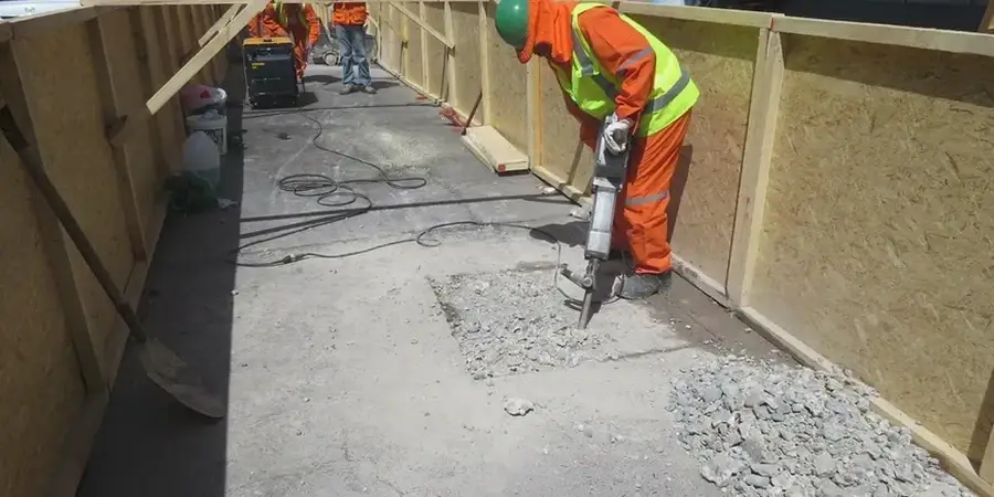
The drill rig groans as it pushes a Shelby tube through seventeen feet of dark, saturated Fat Clay before hitting the water-bearing sands that make tunneling near the Arkansas River a challenge. In Little Rock, the subsurface rarely matches the textbook. We routinely deploy a truck-mounted CME-75 with hollow-stem augers and an auto-hammer for SPT drilling to characterize the transition zones between the overconsolidated clays of the Wilcox Group and the younger, compressible alluvium that blankets the river corridor. The team logs each split-spoon recovery with an eye for the thin silt seams that signal groundwater connectivity, because in this city, a missed interbed can turn a straightforward tunnel drive into a prolonged struggle with face instability and surface settlement. We pair field observations with laboratory consolidation and triaxial testing to build a ground model that accounts for the layered heterogeneity typical of central Arkansas.
A two-foot-thick silt seam at the springline can double the settlement trough width if it goes unrecognized in the ground model.